

“Stand in the place where you live. Now face north. Think about direction, wonder why you haven't before.†Stand—R.E.M.
Did you know that everyone with a smartphone carries around a small homing device in his or her pocket? Once the height of top secret military technology, global positioning systems (GPS) are embedded into a lot of technology, including cell phones. New city? No problem. Bad traffic? An app can show you a shortcut in real time. Thanks to maps and mapping devices, we navigate through our world seamlessly and without thinking. But how?
GPS technology uses satellites to zero in on a unique point in the globe, signified as latitude and longitude. First depicted on maps of the world by ancient Greeks around 300 BC, lines of latitude encircle the globe from east to west, while lines of longitude go north-south. These lines don't actually exist (you can't see the equator), but they give us a common reference system for navigation. (Geographer pro tip: to remember the difference, think “lat†equals “flat,†since latitude is horizontal!)
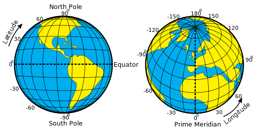
Latitude lines are always parallel. They stack neatly on top of each in smaller and smaller circles from the equator to the poles, like those old stacking donut ring toys. Lines of longitude, in contrast, get closer together until they converge to meet at a single point at the poles. We differentiate individual lines of both latitude and longitude by assigning them degrees. Remember your high school geometry class? There are 360 degrees in a circle, and the equator is just a circle that fits around the center of the earth. Starting at 0, and going halfway around in both directions, we end up with 180 degrees of longitude east and west–think of it like an orange with 360 equal sections to peel apart.
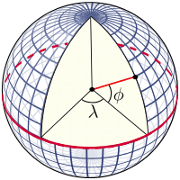
For latitude, picture the equator as the x-axis of a Cartesian plane, while the y-axis goes straight through the middle of the earth, connecting the north and south poles. That intersection forms four right (90 degree) angles. If we draw a perfect circle centered on these axes, latitude lines are assigned their corresponding angle moving from 0-90 degrees. Northern latitudes are positive, and southern latitudes are negative.
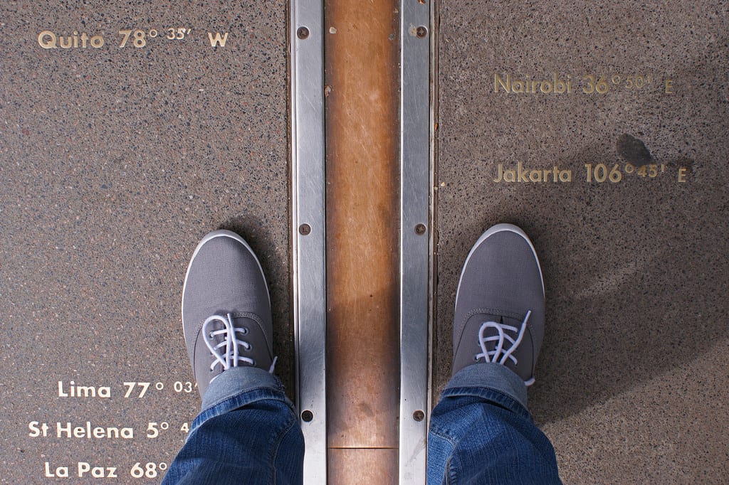
There are a few famous lines of latitude and longitude. Some of these are totally arbitrary, like the Prime Meridian, or 0 degree latitude, which goes straight through Greenwich, England just because the people who invented it lived there. Other markers, though, have a legitimately cool scientific background.
The tropics of Cancer and Capricorn, for example, are lines of latitude at 23.5 degrees north and south, respectively. The tropics mark the limits of where the sun will hit the earth directly (called the subsolar point), instead of at an angle. This corresponds to our seasons, and is the reason why countries in the tropics don't really have distinct summer and winters.
See, due to the tilt of the earth, the location of the earth where the sun is directly overhead at noon will move between the Tropic of Cancer and Capricorn throughout the year. When the subsolar point is directly overhead at its northernmost point, it touches the Tropic of Cancer. This is when the northern hemisphere will have the most direct sunlight all year, and marks the summer solstice. It's the longest day of the year in these latitudes. When the subsolar point at its southernmost location, it's over the Tropic of Capricorn. This is most removed the northern hemisphere will be from direct sunlight all year (and why the sun is lower in the sky in winter!) and marks the winter solstice. What about when the subsolar point is directly over the equator, which happens during spring and fall? Those are the equinoxes!
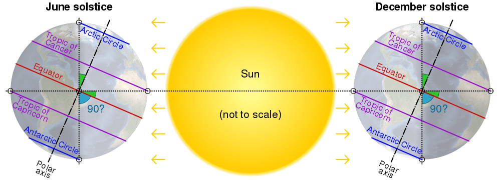
Can you imagine a summer where the sun never sets? Or a winter of constant darkness? During these seasons, locations above or below the arctic circle (~66.5 degrees latitude north and south) will either have no sunlight or constant sunlight, depending on whether the subsolar point is at the tropic farthest or closest to them.
While these imaginary lines are critical to our travel, mobile GPS has only really taken off in the last 15 years or so. First we had dash-mounted GPS units for cars, but those are more or less obsolete, replaced by smartphone mapping apps. Before these devices, people just used actual maps. Without satellites, though, figuring out your exact location on a map was a bit trickier. Stay tuned to hear how our ancestors managed in the next installment of this series, You are Here, Ch2: Navigating with stars.
Feature image credit: Gerard van Schagen via Wikimedia
 Caitlin Mertzlufft is an Athens native, and a PhD candidate in the Integrative Conservation &Geography program at UGA. Caitlin’s research combines geospatial analysis and public health, and she is currently using satellite imagery to estimate Chagas disease transmission in central Panama. When she’s not looking at palm trees from space, she enjoys running, nerdy board games, and all things coffee. Follow her on twitter @CaitlinMertz or send her an email at cmertz2@uga.edu. More from Caitlin Mertzlufft.


